I chose my blogpost on Google Earth and Maps for my signature assignment. It truly has the ability to make history come to life. I developed a map with multiple layers for our study of the Thirteen American Colonies. I envision taking this simple start, two layers with Jamestown and Plymouth, and adding Roanoke to the very beginning and continuing on all the way to Georgia (the last colony founded).
Each colony can be a lesson, with pictures, videos, Padlet links for class discussion, and Google Forms assessments. Awesome, awesome, awesome classroom potential.

Jamestown Colony with pictures…

and a Crash Course YouTube video.
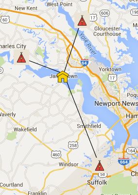
Map showing how Jamestown was surrounded by not-so-friendly Native Americans. The lines can show measurement in miles too!

Second layer added- Plymouth Colony.
I was also very proud of my Wonder HyperDoc I created during 902 Google and Youtube, and don’t want to leave it out. I’ll just link it here.
